Showing posts with label Bronze Age. Show all posts

Friday, 3 November 2023

Earth Mysteries - Torre d'en Galmés - Menorca - Celia Rees


At the beginning of October, I went to Menorca on a Yoga Retreat. Weather perfect, lovely place and I love the Balearics. I've spent time on Ibiza, but I’d never been to Menorca. It is smaller than Ibiza or Majorca, less busy and less well known. 


Apart from the yoga and the prospect of a little sun before winter sets in and the storms start rolling in from the Atlantic, I wanted to see the megalithic sites that are unique to this island. I'd read about them years ago in a book about Earth Mysteries and they were on my list of places I'd like visit. We have plenty of megalithic sites in Britain and I've visited a lot of them, but so many have been worn away, degraded, ironed out by ploughing, their stones robbed for later building by people who had no respect or reverence for those who had occupied the land before them. 


Menorca is a small island and for much of its history sparsely populated, so much survives here. It was also isolated, at the far eastern end of the Balearic archipelago and distant from Continental Europe. The first settlers apparently arrived in the Early Bronze Age and by the end of the 2nd millennium, it had begun to develop its own distinctive culture with large settlements, roads, dwelling places and open spaces surrounding tower shaped monumental structures called talayots. 

Torre D'en Galmés is one such settlement. It occupies an extensive site and is the highest point on the island. It is on the southern coast, looking out to sea. All along this coast are similar sites. Apart from the tower-like talayots, there are stone enclosures, containing monumental structures, Taula (table in Catalan), huge slabs of stone topped by massive stone lintels, eerily reminiscent of Stonehenge and the even more mysterious  Göbekli Tepe in Turkey. What was their purpose? Table? Platform? Altar? Who constructed them? How? And most of all, why? The same mysteries surround these sites as swirl about so many other remnants of ancient cultures that have disappeared from our memory. They suggest many questions but answer very few.  


Very little is known about the purpose of these impressive stone enclosures and the significance of the monumental Taula that they enclose. Some kind of sanctuary where the community could gather to perform celebrations, ceremonies and rituals, but of what nature and to what purpose? There are so many enigmas - the massive size of the monolithic slabs which form the Taula, made of local stone but how did they get the stones there, how did they form them, how did they erect them? As with all these enigmatic remnants of the past, we don't know and will probably never know.


The mystery here might be to do with the positioning of the site. It faces due south and at night, particularly at a time with no light pollution, it would have had an unparalleled view of the southern night sky, Maybe it had something to do with the position of the stars, alignments with a constellation or constellations that the people here regarded as significant.

Eventually, of course, this distinctive culture disappeared. Maybe the stars they saw as so important, lost that vital alignment and the site was abandoned. Or maybe the process was more gradual; as the island became subsumed into the ever expanding Roman Empire, its distinctive difference was erased. The indigenous culture would have survived for a time but gradually the traditions and beliefs would have been lost and the purpose and function of these monumental structures would have receded, like so much else, into the enigma of the past. 


Celia Rees

www.celiarees.com


Wednesday, 4 October 2017

The Magic of Flag Fen - Katherine Langrish


Around 1300 BC, a Bronze Age community living close to a rich wetland area near what is now Peterborough decided to build a massive wooden causeway leading from a point on dry land (now known as Fengate) across the marshy pools and waterways to a natural island about a kilometre out. The causeway was constructed as five long rows of tall sharpened stakes driven into the marsh, with a criss-cross of timbers and brushwood laid between them on which people could walk. It's been estimated over 60,000 individual timbers were used to build the causeway, which followed the line of an earlier, Neolithic track - but the low-lying areas around the island were gradually becoming inundated. The site, known as Flag Fen, was discovered in 1982 by the archeologist Francis Pryor (well known to fans of the popular archeology show Time Team). Archeological investigation has been going at Flag Fen ever since, and there is now a fascinating museum and visitor centre. I’ve long wanted to go there, and my wish came true one bright sunny day a few months ago.


People lived on the margins of the fen in roundhouses like this one, farming, hunting and fishing. They kept sheep, an ancient breed similar to these in the picture below, which were trotting loose about the rural site.


The day I was there, house-martins were flying like darts in and out of the roundhouse, working away to feed their young, who were peeking shyly out of the mud nests plastered to the beams. I wonder if this would have happened in 1300 BC when the fire would have been continually smoking? Perhaps the martins would have built their nests under  the shaggy eaves.


Anyway, within these snug., safe houses - Francis Pryor has described how during the great storm of 1987 he stood in the doorway of the first reconstructed roundhouse on this site, watching sheet-metal roofs tear loose and blow away from the nearby industrial site - our Bronze Age ancestors lived and worked, and, setting out along the causeway they had built, performed ceremonies and made ritual offerings to the waters.

The acid, anaerobic peaty waters don’t preserve bones very well, but they are excellent for preserving wood, leather, and metal. Many bronze swords and spearheads were given to the marsh; gold earrings, pins and brooches have also been found. To whom or what were these dedicated? Perhaps to the dead, the ancestors – there are burial mounds on the island – or perhaps to the spirits of the water and the wild. We may guess; probably we will never know.

There's even a section of excavated causeway visible in situ, albeit housed for protection inside a hut where it's kept from drying out (and therefore crumbling into dust) by a constantly dripping sprinkler system. To stand looking down on the actual timbers which prehistoric people once trod is fascinating even if not, in such a context, terribly romantic. However the photo below doesn't show that the concrete walls of the hut have been painted with trompe l'oeil murals of the prehistoric fen in spring, summer, autumn and winter, stretching away to the horizon, populated with gulls and herons and moorhens and wild ducks.


In his book Britain BC Francis Pryor writes:

The post alignment is indeed a causeway, but it’s far more than that. The main evidence for this is provided by the nearly three hundred finds of prehistoric metalwork made to date. They were found within the area of the posts, and also along their southern side, but not along the northern side which faced ‘out’ ... into the wide-open fen. It’s tempting to view this in symbolic terms: the open fen to the north was seen as being hostile or untamed. It was on this side of the posts that we found the remains of dogs, and the only complete human skeleton. They were in extremely poor condition after lying for thousands of years in the acid peat ... but I reckon the death occurred in the Iron Age – a period when Flag Fen was still in use as an important ceremonial centre. Given what we know about the so-called ‘bog bodies’ of Britain and Scandinavia in the Iron Age, I wouldn’t be at all surprised to learn that the individual [and dogs] had been killed before being thrown into the waters.

Francis Pryor, Britain BC, p 281


Here, above and below, are some of the many beautifully preserved sword blades, and wooden tools.  It’s obvious that prehistoric people used wood for many purposes – as handles and hafts for axes, picks and wooden hammers, and shafts for spears – but wood rots easily, and finds such as these are amazingly rare.


Even more exciting, the museum houses a collection of no less than eight prehistoric log boats, all more or less intact, some with carved decorations and even lifting handles, discovered at a nearby site called Must Farm. These are in the process of being preserved, like the Mary Rose.

If you're anywhere near Peterborough, do visit if you can. We went on a sunny Tuesday morning in early summer. We had the site to ourselves, to wander around and marvel. The sheep trotted past and took shelter under the trees. Fish splashed in the fen; I heard a cuckoo. It was easy almost to imagine oneself back in the past... 


Sunday, 6 September 2015

Ancient History in Sardinia by Lydia Syson

I first fell for Sardinia eight or nine years ago, on a summer house swap. Even the milk cartons charmed me. They used to show a cow standing in front of a crumbling nuraghe – a circular, dry-stone wall structure with a passing resemblance to a Scottish broch, but built considerably earlier, in the Bronze Age.  

Nuraghe Ardasái
© Hans Hillewaert, via Wikimedia Commons
We went to visit one nuraghic site near where we were staying (possibly S’Ortali ‘e Su Monti, near Tortolí) and I have a vague memory of dappled shade, intriguing arrangements of stone, and a very petite guide telling us how incredibly tall the nuraghic people must have been  - at least  5’8”!  But I had four small children in tow, mobile internet wasn’t really ‘a thing’, and when I got back home I never found time to investigate further.

Returning for another family holiday last month, I found the milk cartons replaced by dull plastic bottles. But I also discovered that in the last twenty years the official number of the megalithic towers found on the island has risen almost three-fold to 20,000, and that each one was once in sight of another. Earlier assumptions that their primary purpose was military or defensive are being overturned.

View south from Nuraghe Mannu
As an infectiously enthusiastic guide at the cliff-top site of Nuraghe Mannu explained, ancient Sardinia – mountainous, richly wooded and presumably well-watered in the days before it effectively became a colonial outpost, supplying wood and minerals for a variety of conquerors over the centuries, including of course Rome, both ancient and modern – must surely have been populated by communities who collaborated rather than fighting with each other.  They communicated their sophisticated building techniques and shared other knowledge and beliefs in ways at which we can now only guess.  


View from the ascent of Tiscali


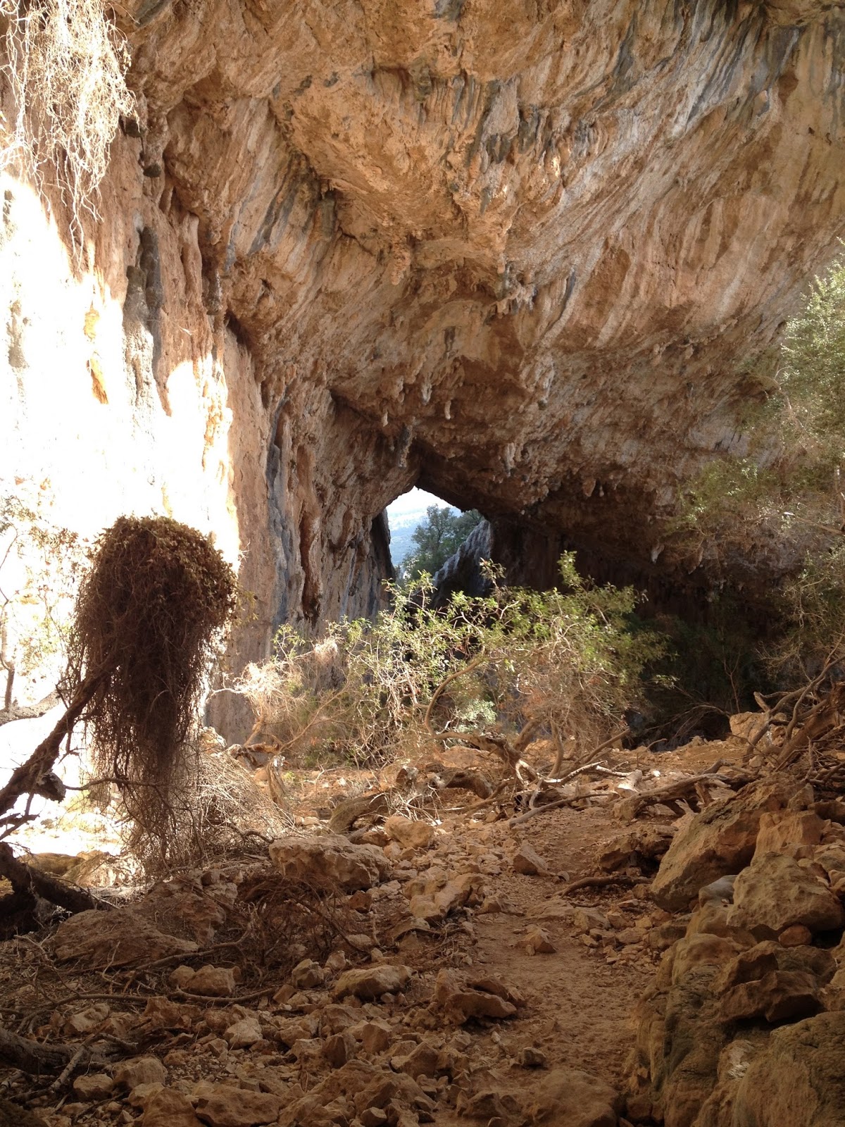
Nuraghe Mannu is one of the easiest sites to get to.  We made a very early start to climb up to another, Tiscali, before the August heat became too intense.  The ruins of this village, well-hidden in a partially collapsed mountain-top cave, a great round karstic sinkhole, date from the very end of the Nuraghic era, or maybe later, first or second century A.D./C.E. 


Tiscali
It’s thought by some to have been a place of refuge at a time when Sardinians were just managing to hold out against the Roman invaders: it’s in the wild area still named Barbagia after Cicero’s description of it as a place of barbarians, and Tiscali remains dramatically and enchantingly inaccessible.  Sadly though, thanks to its remoteness and the fact that it’s only recently been guarded, the site has been repeatedly plundered in the decades since its discovery, leaving it richer in atmosphere than artefacts.

Tiscali


I’ve rarely been anywhere so utterly silent.  Not even a cicada could be heard so early in the day.  And we had the place to ourselves, which I think always makes the mental shift required for imaginative reconstruction a little easier.  Still, I confess I struggled a little to picture the place swarming with people and animals.

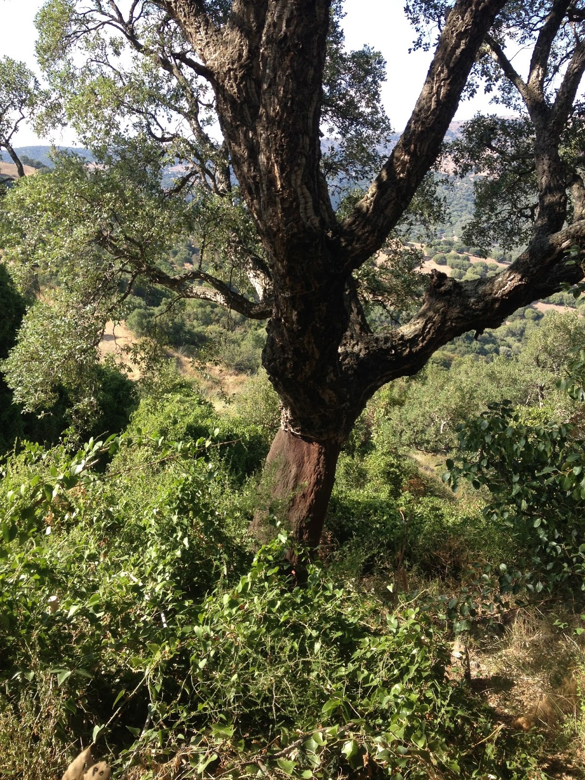
A few days previously, reaching the well temple of Su Tempiesu, still in perfect working order three and a half millennia since it was built, had involved another delightful, steep but altogether shorter walk, through cork oaks, juniper, fennel and fragrant myrtle.

Between visitors, the keeper of Su Tempiesu spends
 his spare time making shepherd's huts and cork watering hose covers

A cork oak
Before we set off, another inspiring and friendly guide showed us around the models, photographs and reproduction bronzetti in the little museum at the top, and explained in patiently slow Italian that the top of the building – originally a truncated pyramid, with twenty votive bronze swords stuck into it with molten lead - had been found in 1953 when the hillside was being terraced to grow tomatoes.  

It was immediately obvious that something 
special was buried beneath the soil as the stones they uncovered were hewn basalt, a volcanic rock which must have been brought to this schist region from at least thirty kilometres away.  The whole complex seems to have been buried by a landslide.  I could absolutely picture the excitement of this discovery, and further investigations thirty years later when the full brilliance of Su Tempiesu’s hydraulic engineering was uncovered as a third, lower pool was unearthed, complete with channels.  Much harder though was visualising the ceremonies that once took place here, and what the significance of its alignment to the equinoxes might have been.

At Nuraghe Mannu, climbing up the steps of a single tower,  
I looked down onto a dense network of low walls spreading out into the undergrowth, wondered exactly who had lived in these houses, and thought how easy I’d had it so far.  Since I started writing historical fiction, I’ve worked in periods so recent I could draw not just on written sources, published and unpublished, but photography, film, and music, never mind artifacts with obvious functions.  I’m not sure if I’ve got the right kind of imagination to take myself back three thousand years or more, to times and places where the evidence is still so sparse, so much archaeological investigation still needs to be done, and about which interpretations are constantly changing.  (In fact, I came home to find this article linking nuraghic Sardinia to Atlantis…) I’d love to know how more daring authors go about this.  I’d find it a truly dizzying prospect, but perhaps others discover a liberation in the mystery and temporal distance?


Some practical stuff if you are in Sardinia:

As you’ll have gathered, there are nuraghic remains all over the island, so you’re sure to find something near by.  Both Tiscali and Su Tempiesu are well worth going off the beaten track for.  For Su Tempiesu, drive to Orune, and you’ll easily pick up signs from the village.  Guidebooks suggest that the walk to Tiscali is much harder than it actually is, and that you might need a guide! Actually, it’s clearly signposted, once you're on the right road from Dorgali, except from the carpark at the bottom, but you just need to keep following the track down to the river bed and over the bridge and then you’ll see the first sign taking you off to the right.  There are a few steep rocky bits on the way up, but nothing very serious and it's lovely and shady a great deal of the way.  If you are reasonably fit you should manage it in 1.5 or 2 hours, allowing the same amount of time to come back down again, but do take plenty of water. And five euros to get in!  I hadn’t found this before we went, but this map could be very useful.


www.lydiasyson.com
The trail winds up to the right and then into the gap behind my head.