
I first fell for Sardinia eight or nine
years ago, on a summer house swap. Even the milk
cartons charmed me. They used to show a cow
standing in front of a crumbling nuraghe – a circular, dry-stone wall structure
with a passing resemblance to a Scottish broch, but built considerably earlier,
in the Bronze Age.
 |
| Nuraghe Ardasái © Hans Hillewaert, via Wikimedia Commons |
We went to visit one
nuraghic site near where we were staying (possibly S’Ortali ‘e Su Monti, near Tortolí) and I have a vague memory of dappled shade, intriguing
arrangements of stone, and a very petite guide telling us how incredibly tall
the nuraghic people must have been - at
least 5’8”! But I had four small children in tow, mobile
internet wasn’t really ‘a thing’, and when I got back home I never found time to investigate further.
Returning for another family holiday last month, I found the milk
cartons replaced by dull plastic bottles. But I also discovered that in the last twenty years the official number
of the megalithic towers found on the island has risen almost three-fold to
20,000, and that each one was once in sight of another. Earlier assumptions that their primary purpose
was military or defensive are being overturned.
 |
| View south from Nuraghe Mannu |
As an infectiously enthusiastic guide at the cliff-top site of Nuraghe
Mannu explained, ancient Sardinia – mountainous, richly wooded and presumably
well-watered in the days before it effectively became a colonial outpost,
supplying wood and minerals for a variety of conquerors over the centuries,
including of course Rome, both ancient and modern – must surely have been populated
by communities who collaborated rather than fighting with each other. They communicated their sophisticated
building techniques and shared other knowledge and beliefs in ways at which we
can now only guess.
 |
| View from the ascent of Tiscali |
Nuraghe Mannu is one of the easiest sites to get to. We made a very early start to climb up to another, Tiscali, before the August heat became too intense. The ruins of this village, well-hidden in a partially collapsed mountain-top cave, a great round karstic sinkhole, date from the very end of the Nuraghic era, or maybe later, first or second century A.D./C.E.
 |
| Tiscali |
It’s thought by some to have been a place of refuge at a time when Sardinians were just managing to hold out against the Roman invaders: it’s in the wild area still named Barbagia after Cicero’s description of it as a place of barbarians, and Tiscali remains dramatically and enchantingly inaccessible. Sadly though, thanks to its remoteness and the fact that it’s only recently been guarded, the site has been repeatedly plundered in the decades since its discovery, leaving it richer in atmosphere than artefacts.
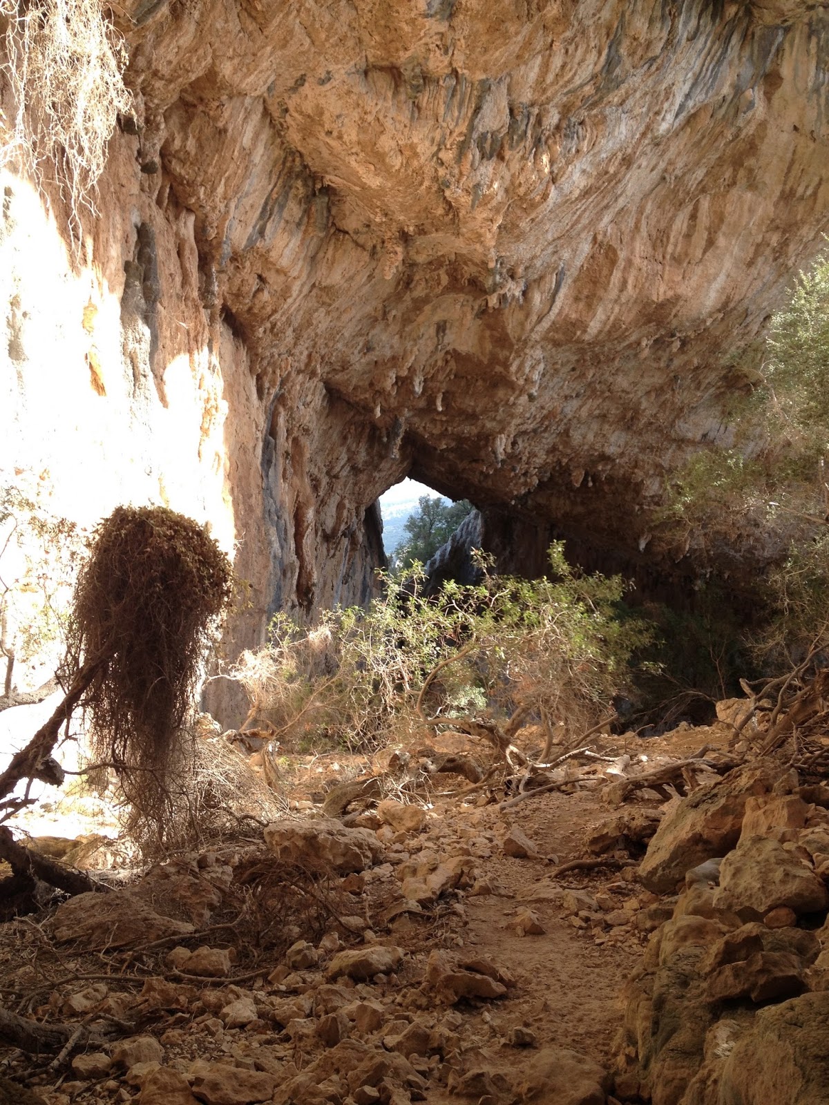 |
| Tiscali |
A few days previously, reaching the well temple of Su Tempiesu, still in perfect working order three and a half millennia since it was built, had involved another delightful, steep but altogether shorter walk, through cork oaks, juniper, fennel and fragrant myrtle.
 |
| Between visitors, the keeper of Su Tempiesu spends his spare time making shepherd's huts and cork watering hose covers |
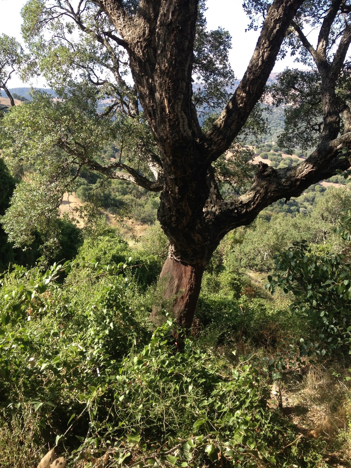 |
| A cork oak |
Before we set off,
another inspiring and friendly guide showed us around the models, photographs and reproduction bronzetti
in the little museum at the top, and explained in patiently slow Italian that
the top of the building – originally a truncated pyramid, with twenty votive
bronze swords stuck into it with molten lead - had been found in 1953 when the
hillside was being terraced to grow tomatoes.

It was immediately obvious that something
special was buried beneath the
soil as the stones they uncovered were hewn basalt, a volcanic rock which must
have been brought to this schist region from at least thirty
kilometres away. The whole complex seems
to have been buried by a landslide. I could absolutely picture the excitement of this
discovery, and further investigations thirty years later when the full
brilliance of Su Tempiesu’s hydraulic engineering was uncovered as a third,
lower pool was unearthed, complete with channels. Much harder though was visualising the ceremonies
that once took place here, and what the significance of its alignment to the
equinoxes might have been.
At Nuraghe Mannu, climbing up the steps of
a single tower,


Some practical stuff if you are in
Sardinia:
As you’ll have gathered, there are nuraghic
remains all over the island, so you’re sure to find something near by. Both Tiscali and Su Tempiesu are well worth
going off the beaten track for. For Su
Tempiesu, drive to Orune, and you’ll easily pick up signs from the
village. Guidebooks suggest that the
walk to Tiscali is much harder than it actually is, and that you might need a
guide! Actually, it’s clearly signposted, once you're on the right road from Dorgali, except from the carpark at the
bottom, but you just need to keep following the track down to the river bed and
over the bridge and then you’ll see the first sign taking you off to the
right. There are a few steep rocky bits
on the way up, but nothing very serious and it's lovely and shady a great deal of the way. If you are reasonably fit you
should manage it in 1.5 or 2 hours, allowing the same amount of time to come back down again, but do take plenty of water. And five euros to get in! I hadn’t found this before we went, but this map could be very useful.
www.lydiasyson.com
 |
| The trail winds up to the right and then into the gap behind my head. |
3 comments:
Thanks for this - the world is so full of places I want to go, and I've now added Sardinia to the list!
I'd definitely make it high!
Very interesting. The line-of-sight aspect of the towers is similar to the pyramid complexes in Egypt that run the old Nile river course. With a simple code employing fire at night or smoke during the day, critical "news" can be communicated great distances in a very short time. (This account also brings to mind sacrificial rituals at fire temples, which were elevated and aligned to solar points in many parts of the world. Google "Strabo fire temple" for some provocative ideas for the historical imagination. )
Post a Comment